


 关联应用
关联应用

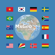
World atlas & map MxGeo Pro
Explore the world virtually
开发者: Hans-Peter Bahn

57天22小时
最新版本上线距今
5
近1年版本更新次数
2016-07-13
全球最早版本上线日期
版本: 9.2.2
版本更新日期
2024-05-06
World atlas & map MxGeo Pro
Explore the world virtually
更新日志
• New: World and continent maps of climate classes
• Improved search for coordinates
• Country comparison: charts for time series based data
• New chart: Population distribution
• Updates and corrections for maps and data
• Bug fixes and improvements
8.9.x:
• Improved river search in map view
• Enhanced chart visualization
8.8.x:
• Improved quiz questions choice
• Enhanced chart visualization
• Country data: More info about languages and international organisations应用描述
World atlas, world map and educational app for geography. Contains over 260 countries and territories of the world with comprehensive economic and geopolitical data. Political maps with regional units (provinces), capitals and major cities included.
• Maps, flags and comprehensive data for over 260 countries and territories of the world
• Interactive political world, continent and country maps
• Shaded relief layer for world and continent maps
• Historical political world and continent maps of 1900, 1930 and 1960
• Geography quiz: capitals, flags, federal states, ...
• Country comparison, favorites and distance calculator
• Print maps and country data
• World-explorer: the smallest, largest, wealthiest, and most populated countries of the world
• World Explorer: largest cities, longest rivers and highest mountains
• Choropleth maps: temperature, area, HDI, population, ...
• Search for countries, major cities, rivers, deserts, lakes, mountains or coordinates
• No online connection required
Explore the world by political continent and country offline maps. Whether Europe, Africa, Asia, Oceania, South and North America: maps of all continents and countries are included. Learn where each country in the world is located. View its position highlighted on a digital globe. Create your favorite color theme or choose from different color schemes for map display.
Do you know the flag of Mauritius? Yes? Perfect. Do you also know in which country Mount Everest is located?
Increase your general geography knowledge in a playful manner. MxGeo Quiz: test your geographic literacy on various topics:
• Do you know the longest rivers on Earth?
• Federal states / provinces for selected countries
• Test your knowledge about the capitals in the world
• Recognize the proper country flag based on the outline map
• Do you know the top-level domains of the world's countries
• Guess the highlighted country on the virtual globe
• Guess the right country by the flag
• Do you know the ISO countries codes of the world?
• Do you know the mountains of the world?
Each quiz offers seven regional variants: World, Europe, Africa, Asia, Oceania, South or North America.
Geo learning app and educational game which is fun for everyone whether children, adults, seniors or teachers. Get ready for your next stay abroad while enjoying this great world almanac including time zones and statistical data, such as population growth, unemployment rate, average age, gross domestic product (GDP) by sector and other key figures. Or prepare for your next geography lesson with this genius digital world map. If not traveling our world atlas lets you explore the world just only virtually.
Enjoy this comprehensive atlas of the World including Europe, Asia, North America, Africa, Oceania and South America with all countries and regional units, capitals and flags.版本: 9.1.3
版本更新日期
2024-02-23

World atlas & map MxGeo Pro
Explore the world virtually
更新日志
• Improved search for coordinates
• Country comparison: charts for time series based data
• New chart: Population distribution
• Updates and corrections for maps and data
• Bug fixes and improvements
8.9.x:
• Improved river search in map view
• Enhanced chart visualization
8.8.x:
• Improved quiz questions choice
• Enhanced chart visualization
• Country data: More info about languages and international organisations
8.6.x:
• New choropleth map: population density
• Country comparison and World Explorer new key indicator: population density
8.3.x:
• Print maps and country data
• Country comparison and World Explorer new key indicator: Gini coefficient
• Historical political world & continent maps of 1930
• Search for islands and island groups
• Search for principal subdivisions like states or provinces
6.8.x:
• Search for countries, major cities, rivers, mountains, lakes and coordinates
• World Explorer: largest cities, longest rivers and highest mountains
• Quiz: the longest rivers on Earth
6.2.x:
• Quiz: Federal states for selected countries
• Country info: government type, climate and date of independence
• Distance calculator: more cities
5.x:
• Administrative subdivision maps for selected countries
• Historical political world & continent maps of 1900 & 1960应用描述
World atlas, world map and educational app for geography. Contains over 260 countries and territories of the world with comprehensive economic and geopolitical data. Political maps with regional units (provinces), capitals and major cities included.
• Maps, flags and comprehensive data for over 260 countries and territories of the world
• Interactive political world, continent and country maps
• Shaded relief layer for world and continent maps
• Historical political world and continent maps of 1900, 1930 and 1960
• Geography quiz: capitals, flags, federal states, ...
• Country comparison, favorites and distance calculator
• Print maps and country data
• World-explorer: the smallest, largest, wealthiest, and most populated countries of the world
• World Explorer: largest cities, longest rivers and highest mountains
• Choropleth maps: temperature, area, HDI, population, ...
• Search for countries, major cities, rivers, deserts, lakes, mountains or coordinates
• No online connection required
Explore the world by political continent and country offline maps. Whether Europe, Africa, Asia, Oceania, South and North America: maps of all continents and countries are included. Learn where each country in the world is located. View its position highlighted on a digital globe. Create your favorite color theme or choose from different color schemes for map display.
Do you know the flag of Mauritius? Yes? Perfect. Do you also know in which country Mount Everest is located?
Increase your general geography knowledge in a playful manner. MxGeo Quiz: test your geographic literacy on various topics:
• Do you know the longest rivers on Earth?
• Federal states / provinces for selected countries
• Test your knowledge about the capitals in the world
• Recognize the proper country flag based on the outline map
• Do you know the top-level domains of the world's countries
• Guess the highlighted country on the virtual globe
• Guess the right country by the flag
• Do you know the ISO countries codes of the world?
• Do you know the mountains of the world?
Each quiz offers seven regional variants: World, Europe, Africa, Asia, Oceania, South or North America.
Geo learning app and educational game which is fun for everyone whether children, adults, seniors or teachers. Get ready for your next stay abroad while enjoying this great world almanac including time zones and statistical data, such as population growth, unemployment rate, average age, gross domestic product (GDP) by sector and other key figures. Or prepare for your next geography lesson with this genius digital world map. If not traveling our world atlas lets you explore the world just only virtually.
Enjoy this comprehensive atlas of the World including Europe, Asia, North America, Africa, Oceania and South America with all countries and regional units, capitals and flags.版本: 9.1.2
版本更新日期
2024-01-12

World atlas & map MxGeo Pro
Explore the world virtually
更新日志
• Updates and corrections for maps and data
• Bug fixes and improvements
• Improved river search in map view
• Enhanced chart visualization应用描述
World atlas, world map and educational app for geography. Contains over 260 countries and territories of the world with comprehensive economic and geopolitical data. Political maps with regional units (provinces), capitals and major cities included.
• Maps, flags and comprehensive data for over 260 countries and territories of the world
• Interactive political world, continent and country maps
• Shaded relief layer for world and continent maps
• Historical political world and continent maps of 1900, 1930 and 1960
• Geography quiz: capitals, flags, federal states, ...
• Country comparison, favorites and distance calculator
• Print maps and country data
• World-explorer: the smallest, largest, wealthiest, and most populated countries of the world
• World Explorer: largest cities, longest rivers and highest mountains
• Choropleth maps: temperature, area, HDI, population, ...
• Search for countries, major cities, rivers, deserts, lakes, mountains or coordinates
• No online connection required
Explore the world by political continent and country offline maps. Whether Europe, Africa, Asia, Oceania, South and North America: maps of all continents and countries are included. Learn where each country in the world is located. View its position highlighted on a digital globe. Create your favorite color theme or choose from different color schemes for map display.
Do you know the flag of Mauritius? Yes? Perfect. Do you also know in which country Mount Everest is located?
Increase your general geography knowledge in a playful manner. MxGeo Quiz: test your geographic literacy on various topics:
• Do you know the longest rivers on Earth?
• Federal states / provinces for selected countries
• Test your knowledge about the capitals in the world
• Recognize the proper country flag based on the outline map
• Do you know the top-level domains of the world's countries
• Guess the highlighted country on the virtual globe
• Guess the right country by the flag
• Do you know the ISO countries codes of the world?
• Do you know the mountains of the world?
Each quiz offers seven regional variants: World, Europe, Africa, Asia, Oceania, South or North America.
Geo learning app and educational game which is fun for everyone whether children, adults, seniors or teachers. Get ready for your next stay abroad while enjoying this great world almanac including time zones and statistical data, such as population growth, unemployment rate, average age, gross domestic product (GDP) by sector and other key figures. Or prepare for your next geography lesson with this genius digital world map. If not traveling our world atlas lets you explore the world just only virtually.
Enjoy this comprehensive atlas of the World including Europe, Asia, North America, Africa, Oceania and South America with all countries and regional units, capitals and flags.版本: 8.9.9
版本更新日期
2023-09-15

World atlas & map MxGeo Pro
Explore the world virtually
更新日志
• Updates and corrections for maps and data
• Improved river search in map view
• Bug fixes and improvements应用描述
World atlas, world map and educational app for geography. Contains over 260 countries and territories of the world with comprehensive economic and geopolitical data. Political maps with regional units (provinces), capitals and major cities included.
• Maps, flags and comprehensive data for over 260 countries and territories of the world
• Interactive political world, continent and country maps
• Shaded relief layer for world and continent maps
• Historical political world and continent maps of 1900, 1930 and 1960
• Geography quiz: capitals, flags, federal states, ...
• Country comparison, favorites and distance calculator
• Print maps and country data
• World-explorer: the smallest, largest, wealthiest, and most populated countries of the world
• World Explorer: largest cities, longest rivers and highest mountains
• Choropleth maps: temperature, area, HDI, population, ...
• Search for countries, major cities, rivers, deserts, lakes, mountains or coordinates
• No online connection required
Explore the world by political continent and country offline maps. Whether Europe, Africa, Asia, Oceania, South and North America: maps of all continents and countries are included. Learn where each country in the world is located. View its position highlighted on a digital globe. Create your favorite color theme or choose from different color schemes for map display.
Do you know the flag of Mauritius? Yes? Perfect. Do you also know in which country Mount Everest is located?
Increase your general geography knowledge in a playful manner. MxGeo Quiz: test your geographic literacy on various topics:
• Do you know the longest rivers on Earth?
• Federal states / provinces for selected countries
• Test your knowledge about the capitals in the world
• Recognize the proper country flag based on the outline map
• Do you know the top-level domains of the world's countries
• Guess the highlighted country on the virtual globe
• Guess the right country by the flag
• Do you know the ISO countries codes of the world?
• Do you know the mountains of the world?
Each quiz offers seven regional variants: World, Europe, Africa, Asia, Oceania, South or North America.
Geo learning app and educational game which is fun for everyone whether children, adults, seniors or teachers. Get ready for your next stay abroad while enjoying this great world almanac including time zones and statistical data, such as population growth, unemployment rate, average age, gross domestic product (GDP) by sector and other key figures. Or prepare for your next geography lesson with this genius digital world map. If not traveling our world atlas lets you explore the world just only virtually.
Enjoy this comprehensive atlas of the World including Europe, Asia, North America, Africa, Oceania and South America with all countries and regional units, capitals and flags.版本: 8.9.7
版本更新日期
2023-07-18

World atlas & map MxGeo Pro
Explore the world virtually
更新日志
• Updates and corrections for maps and data
• Improved quiz questions choice
• Enhanced chart visualization
• Country data: More info about languages and international organisations
• Bug fixes and improvements
8.6.x:
• New choropleth map: population density
• Country comparison and World Explorer new key indicator: population density
8.3.x:
• Print maps and country data
• Country comparison and World Explorer new key indicator: Gini coefficient
• Historical political world & continent maps of 1930
• Search for islands and island groups
• Search for principal subdivisions like states or provinces
6.8.x:
• Search for countries, major cities, rivers, mountains, lakes and coordinates
• World Explorer: largest cities, longest rivers and highest mountains
• Quiz: the longest rivers on Earth
6.2.x:
• Quiz: Federal states for selected countries
• Country info: government type, climate and date of independence
• Distance calculator: more cities
5.x:
• Administrative subdivision maps for selected countries
• Historical political world & continent maps of 1900 & 1960应用描述
World atlas, world map and educational app for geography. Contains over 260 countries and territories of the world with comprehensive economic and geopolitical data. Political maps with regional units (provinces), capitals and major cities included.
• Maps, flags and comprehensive data for over 260 countries and territories of the world
• Interactive political world, continent and country maps
• Shaded relief layer for world and continent maps
• Historical political world and continent maps of 1900, 1930 and 1960
• Geography quiz: capitals, flags, federal states, ...
• Country comparison, favorites and distance calculator
• Print maps and country data
• World-explorer: the smallest, largest, wealthiest, and most populated countries of the world
• World Explorer: largest cities, longest rivers and highest mountains
• Choropleth maps: temperature, area, HDI, population, ...
• Search for countries, major cities, rivers, deserts, lakes, mountains or coordinates
• No online connection required
Explore the world by political continent and country offline maps. Whether Europe, Africa, Asia, Oceania, South and North America: maps of all continents and countries are included. Learn where each country in the world is located. View its position highlighted on a digital globe. Create your favorite color theme or choose from different color schemes for map display.
Do you know the flag of Mauritius? Yes? Perfect. Do you also know in which country Mount Everest is located?
Increase your general geography knowledge in a playful manner. MxGeo Quiz: test your geographic literacy on various topics:
• Do you know the longest rivers on Earth?
• Federal states / provinces for selected countries
• Test your knowledge about the capitals in the world
• Recognize the proper country flag based on the outline map
• Do you know the top-level domains of the world's countries
• Guess the highlighted country on the virtual globe
• Guess the right country by the flag
• Do you know the ISO countries codes of the world?
• Do you know the mountains of the world?
Each quiz offers seven regional variants: World, Europe, Africa, Asia, Oceania, South or North America.
Geo learning app and educational game which is fun for everyone whether children, adults, seniors or teachers. Get ready for your next stay abroad while enjoying this great world almanac including time zones and statistical data, such as population growth, unemployment rate, average age, gross domestic product (GDP) by sector and other key figures. Or prepare for your next geography lesson with this genius digital world map. If not traveling our world atlas lets you explore the world just only virtually.
Enjoy this comprehensive atlas of the World including Europe, Asia, North America, Africa, Oceania and South America with all countries and regional units, capitals and flags.版本: 8.9.6
版本更新日期
2023-06-25

World atlas & map MxGeo Pro
Explore the world virtually
更新日志
• Updates and corrections for maps and data
• Improved quiz questions choice
• Enhanced chart visualization
• Country data: More info about languages and international organisations
• Bug fixes and improvements
8.6.x:
• New choropleth map: population density
• Country comparison and World Explorer new key indicator: population density
8.3.x:
• Print maps and country data
• Country comparison and World Explorer new key indicator: Gini coefficient
• Historical political world & continent maps of 1930
• Search for islands and island groups
• Search for principal subdivisions like states or provinces
6.8.x:
• Search for countries, major cities, rivers, mountains, lakes and coordinates
• World Explorer: largest cities, longest rivers and highest mountains
• Quiz: the longest rivers on Earth
6.2.x:
• Quiz: Federal states for selected countries
• Country info: government type, climate and date of independence
• Distance calculator: more cities
5.x:
• Administrative subdivision maps for selected countries
• Historical political world & continent maps of 1900 & 1960应用描述
World atlas, world map and educational app for geography. Contains over 260 countries and territories of the world with comprehensive economic and geopolitical data. Political maps with regional units (provinces), capitals and major cities included.
• Maps, flags and comprehensive data for over 260 countries and territories of the world
• Interactive political world, continent and country maps
• Shaded relief layer for world and continent maps
• Historical political world and continent maps of 1900, 1930 and 1960
• Geography quiz: capitals, flags, federal states, ...
• Country comparison, favorites and distance calculator
• Print maps and country data
• World-explorer: the smallest, largest, wealthiest, and most populated countries of the world
• World Explorer: largest cities, longest rivers and highest mountains
• Choropleth maps: temperature, area, HDI, population, ...
• Search for countries, major cities, rivers, deserts, lakes, mountains or coordinates
• No online connection required
Explore the world by political continent and country offline maps. Whether Europe, Africa, Asia, Oceania, South and North America: maps of all continents and countries are included. Learn where each country in the world is located. View its position highlighted on a digital globe. Create your favorite color theme or choose from different color schemes for map display.
Do you know the flag of Mauritius? Yes? Perfect. Do you also know in which country Mount Everest is located?
Increase your general geography knowledge in a playful manner. MxGeo Quiz: test your geographic literacy on various topics:
• Do you know the longest rivers on Earth?
• Federal states / provinces for selected countries
• Test your knowledge about the capitals in the world
• Recognize the proper country flag based on the outline map
• Do you know the top-level domains of the world's countries
• Guess the highlighted country on the virtual globe
• Guess the right country by the flag
• Do you know the ISO countries codes of the world?
• Do you know the mountains of the world?
Each quiz offers seven regional variants: World, Europe, Africa, Asia, Oceania, South or North America.
Geo learning app and educational game which is fun for everyone whether children, adults, seniors or teachers. Get ready for your next stay abroad while enjoying this great world almanac including time zones and statistical data, such as population growth, unemployment rate, average age, gross domestic product (GDP) by sector and other key figures. Or prepare for your next geography lesson with this genius digital world map. If not traveling our world atlas lets you explore the world just only virtually.
Enjoy this comprehensive atlas of the World including Europe, Asia, North America, Africa, Oceania and South America with all countries and regional units, capitals and flags.版本: 8.9.3
版本更新日期
2023-04-19
World atlas & map MxGeo Pro
Explore the world virtually
更新日志
• Updates and corrections for maps and data
• Improved quiz questions choice
• Enhanced chart visualization
• Country data: More info about languages and international organisations
• Bug fixes and improvements
8.7.x:
• Updates for Human Development Index (HDI) data
• Updates for economic data (GDP, GDP PC,)
8.6.x:
• New choropleth map: population density
• Country comparison and World Explorer new key indicator: population density
8.3.x:
• Print maps and country data
• Country comparison and World Explorer new key indicator: Gini coefficient
• Historical political world & continent maps of 1930
• Search for islands and island groups
• Search for principal subdivisions like states or provinces
6.8.x:
• Search for countries, major cities, rivers, mountains, lakes and coordinates
• World Explorer: largest cities, longest rivers and highest mountains
• Quiz: the longest rivers on Earth
6.2.x:
• Quiz: Federal states for selected countries
• Country info: government type, climate and date of independence
• Distance calculator: more cities
5.x:
• Administrative subdivision maps for selected countries
• Historical political world & continent maps of 1900 & 1960应用描述
World atlas, world map and educational app for geography. Contains over 260 countries and territories of the world with comprehensive economic and geopolitical data. Political maps with regional units (provinces), capitals and major cities included.
• Maps, flags and comprehensive data for over 260 countries and territories of the world
• Interactive political world, continent and country maps
• Shaded relief layer for world and continent maps
• Historical political world and continent maps of 1900, 1930 and 1960
• Geography quiz: capitals, flags, federal states, ...
• Country comparison, favorites and distance calculator
• Print maps and country data
• World-explorer: the smallest, largest, wealthiest, and most populated countries of the world
• World Explorer: largest cities, longest rivers and highest mountains
• Choropleth maps: temperature, area, HDI, population, ...
• Search for countries, major cities, rivers, deserts, lakes, mountains or coordinates
• No online connection required
Explore the world by political continent and country offline maps. Whether Europe, Africa, Asia, Oceania, South and North America: maps of all continents and countries are included. Learn where each country in the world is located. View its position highlighted on a digital globe. Create your favorite color theme or choose from different color schemes for map display.
Do you know the flag of Mauritius? Yes? Perfect. Do you also know in which country Mount Everest is located?
Increase your general geography knowledge in a playful manner. MxGeo Quiz: test your geographic literacy on various topics:
• Do you know the longest rivers on Earth?
• Federal states / provinces for selected countries
• Test your knowledge about the capitals in the world
• Recognize the proper country flag based on the outline map
• Do you know the top-level domains of the world's countries
• Guess the highlighted country on the virtual globe
• Guess the right country by the flag
• Do you know the ISO countries codes of the world?
• Do you know the mountains of the world?
Each quiz offers seven regional variants: World, Europe, Africa, Asia, Oceania, South or North America.
Geo learning app and educational game which is fun for everyone whether children, adults, seniors or teachers. Get ready for your next stay abroad while enjoying this great world almanac including time zones and statistical data, such as population growth, unemployment rate, average age, gross domestic product (GDP) by sector and other key figures. Or prepare for your next geography lesson with this genius digital world map. If not traveling our world atlas lets you explore the world just only virtually.
Enjoy this comprehensive atlas of the World including Europe, Asia, North America, Africa, Oceania and South America with all countries and regional units, capitals and flags.版本: 8.7.9
版本更新日期
2023-01-31

World atlas & map MxGeo Pro
Explore the world virtually
更新日志
• Updates and corrections for maps and data
• Bug fixes and improvements
8.7.x:
• Updates for Human Development Index (HDI) data
• Updates for economic data (GDP, GDP PC,)
8.6.x:
• New choropleth map: population density
• Country comparison and World Explorer new key indicator: population density
8.3.x:
• Print maps and country data
• Country comparison and World Explorer new key indicator: Gini coefficient
• Historical political world & continent maps of 1930
• Search for islands and island groups
• Search for principal subdivisions like states or provinces
6.8.x:
• Search for countries, major cities, rivers, mountains, lakes and coordinates
• World Explorer: largest cities, longest rivers and highest mountains
• Quiz: the longest rivers on Earth
6.2.x:
• Quiz: Federal states for selected countries
• Country info: government type, climate and date of independence
• Distance calculator: more cities
5.x:
• Administrative subdivision maps for selected countries
• Historical political world & continent maps of 1900 & 1960应用描述
World atlas, world map and educational app for geography. Contains over 260 countries and territories of the world with comprehensive economic and geopolitical data. Political maps with regional units (provinces), capitals and major cities included.
• Maps, flags and comprehensive data for over 260 countries and territories of the world
• Interactive political world, continent and country maps
• Shaded relief layer for world and continent maps
• Historical political world and continent maps of 1900, 1930 and 1960
• Geography quiz: capitals, flags, federal states, ...
• Country comparison, favorites and distance calculator
• Print maps and country data
• World-explorer: the smallest, largest, wealthiest, and most populated countries of the world
• World Explorer: largest cities, longest rivers and highest mountains
• Choropleth maps: temperature, area, HDI, population, ...
• Search for countries, major cities, rivers, deserts, lakes, mountains or coordinates
• No online connection required
Explore the world by political continent and country offline maps. Whether Europe, Africa, Asia, Oceania, South and North America: maps of all continents and countries are included. Learn where each country in the world is located. View its position highlighted on a digital globe. Create your favorite color theme or choose from different color schemes for map display.
Do you know the flag of Mauritius? Yes? Perfect. Do you also know in which country Mount Everest is located?
Increase your general geography knowledge in a playful manner. MxGeo Quiz: test your geographic literacy on various topics:
• Do you know the longest rivers on Earth?
• Federal states / provinces for selected countries
• Test your knowledge about the capitals in the world
• Recognize the proper country flag based on the outline map
• Do you know the top-level domains of the world's countries
• Guess the highlighted country on the virtual globe
• Guess the right country by the flag
• Do you know the ISO countries codes of the world?
• Do you know the mountains of the world?
Each quiz offers seven regional variants: World, Europe, Africa, Asia, Oceania, South or North America.
Geo learning app and educational game which is fun for everyone whether children, adults, seniors or teachers. Get ready for your next stay abroad while enjoying this great world almanac including time zones and statistical data, such as population growth, unemployment rate, average age, gross domestic product (GDP) by sector and other key figures. Or prepare for your next geography lesson with this genius digital world map. If not traveling our world atlas lets you explore the world just only virtually.
Enjoy this comprehensive atlas of the World including Europe, Asia, North America, Africa, Oceania and South America with all countries and regional units, capitals and flags.版本: 8.7.6
版本更新日期
2022-12-22

World atlas & map MxGeo Pro
Explore the world virtually
更新日志
• Updates and corrections for maps and data
• Updates for Human Development Index (HDI) data
• Updates for economic data (GDP, GDP PC, ..)
• Bug fixes and improvements
8.6.x:
• New choropleth map: population density
• Country comparison and World Explorer new key indicator: population density
8.3.x:
• Print maps and country data
• Country comparison and World Explorer new key indicator: Gini coefficient
• New: Historical political world & continent maps of 1930 added
• Search for islands and island groups
• Search for principal subdivisions like states or provinces
6.8.x:
• Search for countries, major cities, rivers, mountains, lakes and coordinates
• World Explorer: largest cities, longest rivers and highest mountains
• New Quiz: Do you know the longest rivers on Earth?
6.2.x:
• Quiz: Federal states for selected countries
• Country info: government type, climate and date of independence
• Distance calculator: more cities
• Dynamic scale bars
5.x:
• Administrative subdivision maps for selected countries
• Historical political world & continent maps of 1900 & 1960应用描述
World atlas, world map and educational app for geography. Contains over 260 countries and territories of the world with comprehensive economic and geopolitical data. Political maps with regional units (provinces), capitals and major cities included.
• Maps, flags and comprehensive data for over 260 countries and territories of the world
• Interactive political world, continent and country maps
• Shaded relief layer for world and continent maps
• Historical political world and continent maps of 1900, 1930 and 1960
• Geography quiz: capitals, flags, federal states, ...
• Country comparison, favorites and distance calculator
• Print maps and country data
• World-explorer: the smallest, largest, wealthiest, and most populated countries of the world
• World Explorer: largest cities, longest rivers and highest mountains
• Choropleth maps: temperature, area, HDI, population, ...
• Search for countries, major cities, rivers, deserts, lakes, mountains or coordinates
• No online connection required
Explore the world by political continent and country offline maps. Whether Europe, Africa, Asia, Oceania, South and North America: maps of all continents and countries are included. Learn where each country in the world is located. View its position highlighted on a digital globe. Create your favorite color theme or choose from different color schemes for map display.
Do you know the flag of Mauritius? Yes? Perfect. Do you also know in which country Mount Everest is located?
Increase your general geography knowledge in a playful manner. MxGeo Quiz: test your geographic literacy on various topics:
• Do you know the longest rivers on Earth?
• Federal states / provinces for selected countries
• Test your knowledge about the capitals in the world
• Recognize the proper country flag based on the outline map
• Do you know the top-level domains of the world's countries
• Guess the highlighted country on the virtual globe
• Guess the right country by the flag
• Do you know the ISO countries codes of the world?
• Do you know the mountains of the world?
Each quiz offers seven regional variants: World, Europe, Africa, Asia, Oceania, South or North America.
Geo learning app and educational game which is fun for everyone whether children, adults, seniors or teachers. Get ready for your next stay abroad while enjoying this great world almanac including time zones and statistical data, such as population growth, unemployment rate, average age, gross domestic product (GDP) by sector and other key figures. Or prepare for your next geography lesson with this genius digital world map. If not traveling our world atlas lets you explore the world just only virtually.
Enjoy this comprehensive atlas of the World including Europe, Asia, North America, Africa, Oceania and South America with all countries and regional units, capitals and flags.版本: 8.7.4
版本更新日期
2022-12-12

World atlas & map MxGeo Pro
Explore the world virtually
更新日志
• Updates and corrections for maps and data
• Updates for Human Development Index (HDI) data
• Updates for economic data (GDP, GDP PC, ..)
• Bug fixes and improvements
8.6.x:
• New choropleth map: population density
• Country comparison and World Explorer new key indicator: population density
8.3.x:
• Print maps and country data
• Country comparison and World Explorer new key indicator: Gini coefficient
• New: Historical political world & continent maps of 1930 added
• Search for islands and island groups
• Search for principal subdivisions like states or provinces
6.8.x:
• Search for countries, major cities, rivers, mountains, lakes and coordinates
• World Explorer: largest cities, longest rivers and highest mountains
• New Quiz: Do you know the longest rivers on Earth?
6.2.x:
• Quiz: Federal states for selected countries
• Country info: government type, climate and date of independence
• Distance calculator: more cities
• Dynamic scale bars
5.x:
• Administrative subdivision maps for selected countries
• Historical political world & continent maps of 1900 & 1960应用描述
World atlas, world map and educational app for geography. Contains over 260 countries and territories of the world with comprehensive economic and geopolitical data. Political maps with regional units (provinces), capitals and major cities included.
• Maps, flags and comprehensive data for over 260 countries and territories of the world
• Interactive political world, continent and country maps
• Shaded relief layer for world and continent maps
• Historical political world and continent maps of 1900, 1930 and 1960
• Geography quiz: capitals, flags, federal states, ...
• Country comparison, favorites and distance calculator
• Print maps and country data
• World-explorer: the smallest, largest, wealthiest, and most populated countries of the world
• World Explorer: largest cities, longest rivers and highest mountains
• Choropleth maps: temperature, area, HDI, population, ...
• Search for countries, major cities, rivers, deserts, lakes, mountains or coordinates
• No online connection required
Explore the world by political continent and country offline maps. Whether Europe, Africa, Asia, Oceania, South and North America: maps of all continents and countries are included. Learn where each country in the world is located. View its position highlighted on a digital globe. Create your favorite color theme or choose from different color schemes for map display.
Do you know the flag of Mauritius? Yes? Perfect. Do you also know in which country Mount Everest is located?
Increase your general geography knowledge in a playful manner. MxGeo Quiz: test your geographic literacy on various topics:
• Do you know the longest rivers on Earth?
• Federal states / provinces for selected countries
• Test your knowledge about the capitals in the world
• Recognize the proper country flag based on the outline map
• Do you know the top-level domains of the world's countries
• Guess the highlighted country on the virtual globe
• Guess the right country by the flag
• Do you know the ISO countries codes of the world?
• Do you know the mountains of the world?
Each quiz offers seven regional variants: World, Europe, Africa, Asia, Oceania, South or North America.
Geo learning app and educational game which is fun for everyone whether children, adults, seniors or teachers. Get ready for your next stay abroad while enjoying this great world almanac including time zones and statistical data, such as population growth, unemployment rate, average age, gross domestic product (GDP) by sector and other key figures. Or prepare for your next geography lesson with this genius digital world map. If not traveling our world atlas lets you explore the world just only virtually.
Enjoy this comprehensive atlas of the World including Europe, Asia, North America, Africa, Oceania and South America with all countries and regional units, capitals and flags.


微信公众号

七麦数据公众号

七麦研究院公众号
APP下载
- IOS
- Android

@2014-2022 qimai.cn,北京七麦科技股份有限公司 All Rights Reserved. 京ICP备14049953号
 京公网安备 11010502041000号


