


 关联应用
关联应用

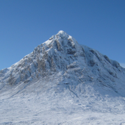
Hill Lists
Munros, Wainwrights and more
开发者: Graham Haley

123天18小时
最新版本上线距今
3
近1年版本更新次数
2009-05-25
全球最早版本上线日期
版本: 7.7.2
版本更新日期
2024-12-23
Hill Lists
Munros, Wainwrights and more
更新日志
Updated to version 18.2 of the Database of British and Irish Hills (DoBIH), a minor update affecting the Dodds, Tumps, County Tops, Humps, Simms, Hewitts and Arderins.
Fixed links to hill-bagging.co.uk.应用描述
First released in 2009, this popular application includes data for almost 20,000 hills in the UK and Ireland, plus over 90 lists including ...
Munros and Munro Tops, Corbetts, Grahams, Donalds, Furths, Marilyns, Wainwrights and Outlying Fells, Birketts, all County Tops and many more.
Almost an entire lifetime of hill walking. If you run out, please let me know!
FEATURES
- Choose the lists you would like to complete, and view counts per list (hills completed, total and percentage)
- View each list on a map, and animate your journey in the order climbed
- Sort lists by section/book number/region, name, height, distance, date climbed or ascents
- Add your own lists based on region, drop, height ... etc
- View all ascents in the app, sorted by date climbed
- View all hills in the app sorted alphabetically, by distance from your default location, section, height ... etc
- Track completed hills by ticking those you have climbed, adding the date and any notes for each ascent
- Supports multiple ascents (per hill) and multiple rounds (of lists)
- See route information for popular hills, provided via external links to the Walk Highlands and MountainViews websites
- View up-to-date weather information for selected regions in Scotland, Wales and England, provided by the Mountain Weather Information Service (MWIS) website
- Share your location by email or SMS/text when you get to the top of each hill
- See statistics of your ascents, e.g. a breakdown per month or by year, plus a list of most frequently climbed hills
- Browse nearby hills on a map
- Set your default location by searching for places or postcodes
- Backup your data and sync it between devices using iCloud, Dropbox, AirDrop or email
- Universal app, works on the iPhone, iPod Touch and iPad
DATA, ROUTES AND WEATHER
The data for the UK and Ireland has been extracted from version 18.2 of the Database of British and Irish Hills (DoBIH), with kind permission from Chris Crocker and Alan Dawson.
Route information for the Munros, Corbetts, most of the Grahams, Donalds, Wainwrights, Hewitts and most of the Trail 100 is provided via external links to the Walk Highlands website.
Route information for all the lists in Ireland is provided via external links to the MountainViews website.
Weather information for Scotland, England and Wales is provided by the MWIS website.
SUPPORT
Please use the link to my support page from the App Store page or from the app itself (or simply go to http://grahamhaley.co.uk/hills/).
Alternatively, contact me directly via my support pages and you will get a quick response.版本: 7.7.1
版本更新日期
2024-10-06

Hill Lists
Munros, Wainwrights and more
更新日志
Fixed a map display issue when viewing unclimbed hills in a list.应用描述
First released in 2009, this popular application includes data for almost 20,000 hills in the UK and Ireland, plus over 90 lists including ...
Munros and Munro Tops, Corbetts, Grahams, Donalds, Furths, Marilyns, Wainwrights and Outlying Fells, Birketts, all County Tops and many more.
Almost an entire lifetime of hill walking. If you run out, please let me know!
FEATURES
- Choose the lists you would like to complete, and view counts per list (hills completed, total and percentage)
- View each list on a map, and animate your journey in the order climbed
- Sort lists by section/book number/region, name, height, distance, date climbed or ascents
- Add your own lists based on region, drop, height ... etc
- View all ascents in the app, sorted by date climbed
- View all hills in the app sorted alphabetically, by distance from your default location, section, height ... etc
- Track completed hills by ticking those you have climbed, adding the date and any notes for each ascent
- Supports multiple ascents (per hill) and multiple rounds (of lists)
- See route information for popular hills, provided via external links to the Walk Highlands and MountainViews websites
- View up-to-date weather information for selected regions in Scotland, Wales and England, provided by the Mountain Weather Information Service (MWIS) website
- Share your location by email or SMS/text when you get to the top of each hill
- See statistics of your ascents, e.g. a breakdown per month or by year, plus a list of most frequently climbed hills
- Browse nearby hills on a map
- Set your default location by searching for places or postcodes
- Backup your data and sync it between devices using iCloud, Dropbox, AirDrop or email
- Universal app, works on the iPhone, iPod Touch and iPad
DATA, ROUTES AND WEATHER
The data for the UK and Ireland has been extracted from version 18.1 of the Database of British and Irish Hills (DoBIH), with kind permission from Chris Crocker and Alan Dawson.
Route information for the Munros, Corbetts, most of the Grahams, Donalds, Wainwrights, Hewitts and most of the Trail 100 is provided via external links to the Walk Highlands website.
Route information for all the lists in Ireland is provided via external links to the MountainViews website.
Weather information for Scotland, England and Wales is provided by the MWIS website.
SUPPORT
Please use the link to my support page from the App Store page or from the app itself (or simply go to http://grahamhaley.co.uk/hills/).
Alternatively, contact me directly via my support pages and you will get a quick response.版本: 7.7
版本更新日期
2024-08-31
Hill Lists
Munros, Wainwrights and more
更新日志
Updated to version 18.1 of the Database of British and Irish Hills (DoBIH).
Added the Irish SIBs (Significant Islands of the British Isles).
Added more options for exporting backups and CSV files, e.g. AirDrop, Messages, save to Files ... etc.
When sharing your location, this now include an OS grid reference.应用描述
暂无应用描述数据
版本: 7.6
版本更新日期
2023-09-27

Hill Lists
Munros, Wainwrights and more
更新日志
Updated to version 18 of the Database of British and Irish Hills (DoBIH), adding two new lists: the Ethels and Alan Dawson's High Hills of Britain.应用描述
First released in 2009, this popular application includes data for almost 20,000 hills in the UK and Ireland, plus over 90 lists including ...
Munros and Munro Tops, Corbetts, Grahams, Donalds, Furths, Marilyns, Wainwrights and Outlying Fells, Birketts, all County Tops and many more.
Almost an entire lifetime of hill walking. If you run out, please let me know!
FEATURES
- Choose the lists you would like to complete, and view counts per list (hills completed, total and percentage)
- View each list on a map, and animate your journey in the order climbed
- Sort lists by section/book number/region, name, height, distance, date climbed or ascents
- Add your own lists based on region, drop, height ... etc
- View all ascents in the app, sorted by date climbed
- View all hills in the app sorted alphabetically, by distance from your default location, section, height ... etc
- Track completed hills by ticking those you have climbed, adding the date and any notes for each ascent
- Supports multiple ascents (per hill) and multiple rounds (of lists)
- See route information for popular hills, provided via external links to the Walk Highlands and MountainViews websites
- View up-to-date weather information for selected regions in Scotland, Wales and England, provided by the Mountain Weather Information Service (MWIS) website
- Share your location by email or SMS/text when you get to the top of each hill
- See statistics of your ascents, e.g. a breakdown per month or by year, plus a list of most frequently climbed hills
- Browse nearby hills on a map
- Set your default location by searching for places or postcodes
- Backup your data and sync it between devices using iCloud, Dropbox, AirDrop or email
- Universal app, works on the iPhone, iPod Touch and iPad
DATA, ROUTES AND WEATHER
The data for the UK and Ireland has been extracted from version 18 of the Database of British and Irish Hills (DoBIH), with kind permission from Chris Crocker and Alan Dawson.
Route information for the Munros, Corbetts, most of the Grahams, Donalds, Wainwrights, Hewitts and most of the Trail 100 is provided via external links to the Walk Highlands website.
Route information for all the lists in Ireland is provided via external links to the MountainViews website.
Weather information for Scotland, England and Wales is provided by the MWIS website.
SUPPORT
Please use the link to my support page from the App Store page or from the app itself (or simply go to http://grahamhaley.co.uk/hills/).
Alternatively, contact me directly via my support pages and you will get a quick response.版本: 7.5
版本更新日期
2023-01-17
Hill Lists
Munros, Wainwrights and more
更新日志
Updated to version 17.5 of the Database of British and Irish Hills, with significant changes to the Grahams, Graham Tops and Highland Fives. See the user guide for details.
Added support for up to 3 user defined lists, where you can set the criteria (region, drop, height ... etc). Select Edit on the lists view and scroll to the bottom.
Re-enabled the multiple rounds setting. If disabled, only your first round of each list is tracked.应用描述
First released in 2009, this popular application includes data for almost 20,000 hills in the UK and Ireland, plus over 90 lists including ...
Munros and Munro Tops, Corbetts, Grahams, Donalds, Furths, Marilyns, Wainwrights and Outlying Fells, Birketts, all County Tops and many more.
Almost an entire lifetime of hill walking. If you run out, please let me know!
FEATURES
- Choose the lists you would like to complete, and view counts per list (hills completed, total and percentage)
- View each list on a map, and animate your journey in the order climbed
- Sort lists by section/book number/region, name, height, distance, date climbed or ascents
- Add your own lists based on region, drop, height ... etc
- View all ascents in the app, sorted by date climbed
- View all hills in the app sorted alphabetically, by distance from your default location, section, height ... etc
- Track completed hills by ticking those you have climbed, adding the date and any notes for each ascent
- Supports multiple ascents (per hill) and multiple rounds (of lists)
- See route information for popular hills, provided via external links to the Walk Highlands and MountainViews websites
- View up-to-date weather information for selected regions in Scotland, Wales and England, provided by the Mountain Weather Information Service (MWIS) website
- Share your location by email or SMS/text when you get to the top of each hill
- See statistics of your ascents, e.g. a breakdown per month or by year, plus a list of most frequently climbed hills
- Browse nearby hills on a map
- Set your default location by searching for places or postcodes
- Backup your data and sync it between devices using iCloud, Dropbox, AirDrop or email
- Universal app, works on the iPhone, iPod Touch and iPad
DATA, ROUTES AND WEATHER
The data for the UK and Ireland has been extracted from version 17.5 of the Database of British and Irish Hills (DoBIH), with kind permission from Chris Crocker and Alan Dawson.
Route information for the Munros, Corbetts, most of the Grahams, Donalds, Wainwrights, Hewitts and most of the Trail 100 is provided via external links to the Walk Highlands website.
Route information for all the lists in Ireland is provided via external links to the MountainViews website.
Weather information for Scotland, England and Wales is provided by the MWIS website.
SUPPORT
Please use the link to my support page from the App Store page or from the app itself (or simply go to http://grahamhaley.co.uk/hills/).
Alternatively, contact me directly via my support pages and you will get a quick response.版本: 7.4.2
版本更新日期
2022-07-28

Hill Lists
Munros, Wainwrights and more
更新日志
Updated to version 17.4 of the Database of British and Irish Hills, a routine update with minor changes to the Humps, Simms, Dodds, Nuttalls, Tumps, County Tops and Arderins.应用描述
First released in 2009, this popular application includes data for almost 20,000 hills in the UK and Ireland, plus over 90 lists including ...
Munros and Munro Tops, Corbetts, Grahams, Donalds, Furths, Marilyns, Wainwrights and Outlying Fells, Birketts, all County Tops and many more.
Almost an entire lifetime of hill walking. If you run out, please let me know!
FEATURES
- Choose the lists you would like to complete, and view counts per list (hills completed, total and percentage)
- View each list on a map, and animate your journey in the order climbed
- Sort lists by section/book number, name, height, distance, date climbed or ascents
- View all ascents in the app, sorted by date climbed
- View all hills in the app sorted alphabetically, by distance from your default location, section, height ... etc
- Track completed hills by ticking those you have climbed, adding the date and any notes for each ascent
- Supports multiple ascents (per hill) and multiple rounds (of lists)
- See route information for popular hills, provided via external links to the Walk Highlands and MountainViews websites
- View up-to-date weather information for selected regions in Scotland, Wales and England, provided by the Mountain Weather Information Service (MWIS) website
- Share your location by email or SMS/text when you get to the top of each hill
- See statistics of your ascents, e.g. a breakdown per month or by year, plus a list of most frequently climbed hills
- Browse nearby hills on a map
- Set your default location by searching for places or postcodes
- Backup your data and sync it between devices using iCloud, Dropbox, AirDrop or email
- Universal app, works on the iPhone, iPod Touch and iPad
DATA, ROUTES AND WEATHER
The data for the UK and Ireland has been extracted from version 17.4 of the Database of British and Irish Hills (DoBIH), with kind permission from Chris Crocker and Alan Dawson.
Route information for the Munros, Corbetts, Grahams, Donalds, Wainwrights, Hewitts and most of the Trail 100 is provided via external links to the Walk Highlands website.
Route information for all the lists in Ireland is provided via external links to the MountainViews website.
Weather information for Scotland, England and Wales is provided by the MWIS website.
SUPPORT
Please use the link to my support page from the App Store page or from the app itself (or simply go to http://grahamhaley.co.uk/hills/).
Alternatively, contact me directly via my support pages and you will get a quick response.版本: 7.4.1
版本更新日期
2022-05-23

Hill Lists
Munros, Wainwrights and more
更新日志
Fixed an issue with Dropbox authentication (i.e. linking to the app) timing out after 4 hours.应用描述
First released in 2009, this popular application includes data for almost 20,000 hills in the UK and Ireland, plus over 90 lists including ...
Munros and Munro Tops, Corbetts, Grahams, Donalds, Furths, Marilyns, Wainwrights and Outlying Fells, Birketts, all County Tops and many more.
Almost an entire lifetime of hill walking. If you run out, please let me know!
FEATURES
- Choose the lists you would like to complete, and view counts per list (hills completed, total and percentage)
- View each list on a map, and animate your journey in the order climbed
- Sort lists by section/book number, name, height, distance, date climbed or ascents
- View all ascents in the app, sorted by date climbed
- View all hills in the app sorted alphabetically, by distance from your default location, section, height ... etc
- Track completed hills by ticking those you have climbed, adding the date and any notes for each ascent
- Supports multiple ascents (per hill) and multiple rounds (of lists)
- See route information for popular hills, provided via external links to the Walk Highlands and MountainViews websites
- View up-to-date weather information for selected regions in Scotland, Wales and England, provided by the Mountain Weather Information Service (MWIS) website
- Share your location by email or SMS/text when you get to the top of each hill
- See statistics of your ascents, e.g. a breakdown per month or by year, plus a list of most frequently climbed hills
- Browse nearby hills on a map
- Set your default location by searching for places or postcodes
- Backup your data and sync it between devices using iCloud, Dropbox, AirDrop or email
- Universal app, works on the iPhone, iPod Touch and iPad
DATA, ROUTES AND WEATHER
The data for the UK and Ireland has been extracted from version 17.3 of the Database of British and Irish Hills (DoBIH), with kind permission from Chris Crocker and Alan Dawson.
Route information for the Munros, Corbetts, Grahams, Donalds, Wainwrights, Hewitts and most of the Trail 100 is provided via external links to the Walk Highlands website.
Route information for all the lists in Ireland is provided via external links to the MountainViews website.
Weather information for Scotland, England and Wales is provided by the MWIS website.
SUPPORT
Please use the link to my support page from the App Store page or from the app itself (or simply go to http://grahamhaley.co.uk/hills/).
Alternatively, contact me directly via my support pages and you will get a quick response.版本: 7.4
版本更新日期
2022-04-05

Hill Lists
Munros, Wainwrights and more
更新日志
When searching for a hill, include alternative names too.
Added options to the unclimbed hills map accessed by swiping right to left on the lists view. For Munro Tops and deleted Munros, this includes showing the current Munros in grey (I find this useful when planning trips).
Added a top unclimbed hills section to the bottom of the dashboard view. This only includes hills in your tracked lists.
Added a fourth, darker colour theme, selected from the settings screen.
Minor layout improvements.应用描述
First released in 2009, this popular application includes data for almost 20,000 hills in the UK and Ireland, plus over 90 lists including ...
Munros and Munro Tops, Corbetts, Grahams, Donalds, Furths, Marilyns, Wainwrights and Outlying Fells, Birketts, all County Tops and many more.
Almost an entire lifetime of hill walking. If you run out, please let me know!
FEATURES
- Choose the lists you would like to complete, and view counts per list (hills completed, total and percentage)
- View each list on a map, and animate your journey in the order climbed
- Sort lists by section/book number, name, height, distance, date climbed or ascents
- View all ascents in the app, sorted by date climbed
- View all hills in the app sorted alphabetically, by distance from your default location, section, height ... etc
- Track completed hills by ticking those you have climbed, adding the date and any notes for each ascent
- Supports multiple ascents (per hill) and multiple rounds (of lists)
- See route information for popular hills, provided via external links to the Walk Highlands and MountainViews websites
- View up-to-date weather information for selected regions in Scotland, Wales and England, provided by the Mountain Weather Information Service (MWIS) website
- Share your location by email or SMS/text when you get to the top of each hill
- See statistics of your ascents, e.g. a breakdown per month or by year, plus a list of most frequently climbed hills
- Browse nearby hills on a map
- Set your default location by searching for places or postcodes
- Backup your data and sync it between devices using iCloud, Dropbox, AirDrop or email
- Universal app, works on the iPhone, iPod Touch and iPad
DATA, ROUTES AND WEATHER
The data for the UK and Ireland has been extracted from version 17.3 of the Database of British and Irish Hills (DoBIH), with kind permission from Chris Crocker and Alan Dawson.
Route information for the Munros, Corbetts, Grahams, Donalds, Wainwrights, Hewitts and most of the Trail 100 is provided via external links to the Walk Highlands website.
Route information for all the lists in Ireland is provided via external links to the MountainViews website.
Weather information for Scotland, England and Wales is provided by the MWIS website.
SUPPORT
Please use the link to my support page from the App Store page or from the app itself (or simply go to http://grahamhaley.co.uk/hills/).
Alternatively, contact me directly via my support pages and you will get a quick response.版本: 7.3
版本更新日期
2021-12-29

Hill Lists
Munros, Wainwrights and more
更新日志
Updated the underlying Database of British and Irish Hills (DoBIH) to version 17.3.
Added separate county tops lists for Scotland, Wales and England.
Added more detailed stats for tracked and completed lists, and for each month and year in the dashboard view. Swipe right to left and choose Stats.
As an example you can now track which days per month you have climbed hills on (or not, if you want to fill in the gaps).
Minor changes for iOS 15 compatability.应用描述
First released in 2009, this popular application includes data for almost 20,000 hills in the UK and Ireland, plus over 90 lists including ...
Munros and Munro Tops, Corbetts, Grahams, Donalds, Furths, Marilyns, Wainwrights and Outlying Fells, Birketts, all County Tops and many more.
Almost an entire lifetime of hill walking. If you run out, please let me know!
FEATURES
- Choose the lists you would like to complete, and view counts per list (hills completed, total and percentage)
- View each list on a map, and animate your journey in the order climbed
- Sort lists by section/book number, name, height, distance, date climbed or ascents
- View all ascents in the app, sorted by date climbed
- View all hills in the app sorted alphabetically, by distance from your default location, section, height ... etc
- Track completed hills by ticking those you have climbed, adding the date and any notes for each ascent
- Supports multiple ascents (per hill) and multiple rounds (of lists)
- See route information for popular hills, provided via external links to the Walk Highlands and MountainViews websites
- View up-to-date weather information for selected regions in Scotland, Wales and England, provided by the Mountain Weather Information Service (MWIS) website
- Share your location by email or SMS/text when you get to the top of each hill
- See statistics of your ascents, e.g. a breakdown per month or by year, plus a list of most frequently climbed hills
- Browse nearby hills on a map
- Set your default location by searching for places or postcodes
- Backup your data and sync it between devices using iCloud, Dropbox, AirDrop or email
- Universal app, works on the iPhone, iPod Touch and iPad
DATA, ROUTES AND WEATHER
The data for the UK and Ireland has been extracted from version 17.3 of the Database of British and Irish Hills (DoBIH), with kind permission from Chris Crocker and Alan Dawson.
Route information for the Munros, Corbetts, Grahams, Donalds, Wainwrights, Hewitts and most of the Trail 100 is provided via external links to the Walk Highlands website.
Route information for all the lists in Ireland is provided via external links to the MountainViews website.
Weather information for Scotland, England and Wales is provided by the MWIS website.
SUPPORT
Please use the link to my support page from the App Store page or from the app itself (or simply go to http://grahamhaley.co.uk/hills/).
Alternatively, contact me directly via my support pages and you will get a quick response.版本: 7.2
版本更新日期
2021-08-14

Hill Lists
Munros, Wainwrights and more
更新日志
Moved to version 17.2 of the Database of British and Irish Hills (DoBIH), a routine update that reinstates Dugland to the Donald Tops, plus some minor changes to the Marilyns, Humps, Simms, Dodds, Donald Deweys, Tumps and SIBs.
Added regional lists for Scotland, Wales, England and Ireland.
For Scottish lists, the To Do section header shows separate counts for south and north of the Great Glen, plus the Islands.应用描述
First released in 2009, this popular application includes data for almost 20,000 hills in the UK and Ireland, plus over 80 lists including ...
Munros and Munro Tops, Corbetts, Grahams, Donalds, Furths, Marilyns, Wainwrights and Outlying Fells, Birketts, all County Tops and many more.
Almost an entire lifetime of hill walking. If you run out, please let me know!
FEATURES
- Choose the lists you would like to complete, and view counts per list (hills completed, total and percentage)
- View each list on a map, and animate your journey in the order climbed
- Sort lists by section/book number, name, height, distance, date climbed or ascents
- View all ascents in the app, sorted by date climbed
- View all hills in the app sorted alphabetically, by distance from your default location, section, height ... etc
- Track completed hills by ticking those you have climbed, adding the date and any notes for each ascent
- Supports multiple ascents (per hill) and multiple rounds (of lists)
- See route information for popular hills, provided via external links to the Walk Highlands and MountainViews websites
- View up-to-date weather information for selected regions in Scotland, Wales and England, provided by the Mountain Weather Information Service (MWIS) website
- Share your location by email or SMS/text when you get to the top of each hill
- See statistics of your ascents, e.g. a breakdown per month or by year, plus a list of most frequently climbed hills
- Browse nearby hills on a map
- Set your default location by searching for places or postcodes
- Backup your data and sync it between devices using iCloud, Dropbox, AirDrop or email
- Universal app, works on the iPhone, iPod Touch and iPad
DATA, ROUTES AND WEATHER
The data for the UK and Ireland has been extracted from version 17.2 of the Database of British and Irish Hills (DoBIH), with kind permission from Chris Crocker and Alan Dawson.
Route information for the Munros, Corbetts, Grahams, Donalds, Wainwrights, Hewitts and most of the Trail 100 is provided via external links to the Walk Highlands website.
Route information for all the lists in Ireland is provided via external links to the MountainViews website.
Weather information for Scotland, England and Wales is provided by the MWIS website.
SUPPORT
Please use the link to my support page from the App Store page or from the app itself (or simply go to http://grahamhaley.co.uk/hills/).
Alternatively, contact me directly via my support pages and you will get a quick response.


微信公众号

七麦数据公众号

七麦研究院公众号
APP下载
- IOS
- Android

@2014-2022 qimai.cn,北京七麦科技股份有限公司 All Rights Reserved. 京ICP备14049953号
 京公网安备 11010502041000号


