


 关联应用
关联应用

MapPath Pro
GPS Tracker, Map Measure Tool
开发者: Julien Rozé

28天1小时
最新版本上线距今
2
近1年版本更新次数
2012-03-27
全球最早版本上线日期
版本: 9.1
版本更新日期
2025-09-28
MapPath Pro
GPS Tracker, Map Measure Tool
更新日志
- Added a new option to select the unit of measurement for area
- Added "Hectare" as a unit of measurement for area
- The pin indicating the resumption of a route is now blue, to differentiate it from the green pin indicating the start of the route
- It is now possible again to tap on your location on the map to see the accuracy of your GPS position应用描述
MapPath is an easy-to-use app allowing you to record your trips.
It displays your track, your position and live information such as your speed, altitude and average speed/pace.
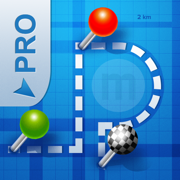
MapPath is also an utility that allows you to establish directions, measure distances, surface areas and perimeters by dragging pins (points) on the map.
# GPS Tracker Features :
- record your run: time, distance, altitude, speed, average speed, average pace
- pause and resume recording as needed
- display your track on the map
- display charts of your altitude, speed and pace
- location and heading tracking
- cut portion of the track
- display simultaneously several tracks on the map
- change color of each track on the map
# Measures Features :
- directions up to 30 steps
- measure distances, surface areas and perimeters using pins (points) on the map
- add point to your measure by taping and holding the map
- display simultaneously several measures on the map
- change color of each measure on the map
# Import / Export Features :
- import and export tracks and measures as KML, KMZ, ITN, GPX and CSV files
# Options :
- gps accuracy options
- system of units options : speed, distance, altitude, coordinates
- map types selection : Apple standard & satellite (3D) maps, OpenStreetMap, OpenSeaMap and custom maps
- options to show Traffic and Points of Interest
# And also :
- Dark Mode
- Split View and Slide Over multitasking on iPad
- Widgets and Live Activities displaying informations about your current location or current tracking directly from your lock screen, home screen or the Dynamic Island (since iPhone 14)
MapPath use iCloud to automatically keep in sync your tracks and measures across your devices.
If you have any problem, suggestion, please feel free to contact me at contact@julienroze.fr
Note that continued use of GPS running in the background can dramatically decrease battery life.版本: 9.0
版本更新日期
2025-09-15
MapPath Pro
GPS Tracker, Map Measure Tool
更新日志
iOS26 new Liquid Glass design support应用描述
暂无应用描述数据
版本: 8.1
版本更新日期
2024-09-14
MapPath Pro
GPS Tracker, Map Measure Tool
更新日志
Fixes inability to access certain options on some devices应用描述
暂无应用描述数据
版本: 8.0
版本更新日期
2024-08-09
MapPath Pro
GPS Tracker, Map Measure Tool
更新日志
MapPath 8.0 is full of new features:
- A new Widget is available to display information about your current location directly from your home screen (address, latitude, longitude, altitude)
- MapPath now supports "Live Activities" to display current tracking informations directly from the lock screen and from the "Dynamic Island" on iPhone 14 and above
- Coordinates can now be displayed in different formats: D°M'S" (default), D°M.M', D.D° or UTM
- A new option allows you to choose to display your average pace (minutes per km) instead of average speed (km/h)应用描述
暂无应用描述数据
版本: 7.9
版本更新日期
2023-09-30

MapPath Pro
GPS Tracker, Map Measure Tool
更新日志
This version fixes an issue when exporting multiple tracks/measures with the same name (thanks Timo)应用描述
MapPath is an easy-to-use app allowing you to record your trips.
It displays your track, your position and live information such as your speed, altitude or average speed.
MapPath is also an utility that allows you to establish directions, measure distances, surface areas and perimeters by dragging pins (points) on the map.
# GPS Tracker Features :
- record your run: time, distance, altitude, speed, average speed
- pause and resume recording as needed
- display your track on the map
- display charts of your altitude, speed and pace
- location and heading tracking
- cut portion of the track
- display simultaneously several tracks on the map
- change color of each track on the map
# Measures Features :
- directions up to 30 steps
- measure distances, surface areas and perimeters using pins (points) on the map
- add point to your measure by taping and holding the map
- display simultaneously several measures on the map
- change color of each measure on the map
# Import / Export Features :
- import and export tracks and measures as KML, KMZ, ITN, GPX and CSV files
# Options :
- gps accuracy options
- system of units options
- map types selection : Apple standard & satellite (3D) maps, OpenStreetMap, OpenSeaMap and custom maps
- options to show Traffic and Points of Interest
# And also :
- Dark Mode
- Split View and Slide Over multitasking on iPad
- Widget displaying informations about your current location or current tracking
MapPath use iCloud to automatically keep in sync your tracks and measures across your devices.
If you have any problem, suggestion, please feel free to contact me at contact@julienroze.fr
Note that continued use of GPS running in the background can dramatically decrease battery life.版本: 7.8
版本更新日期
2022-10-06

MapPath Pro
GPS Tracker, Map Measure Tool
更新日志
Fixes a display issue with OpenStreetMap应用描述
MapPath is an easy-to-use app allowing you to record your trips.
It displays your track, your position and live information such as your speed, altitude or average speed.
MapPath is also an utility that allows you to establish directions, measure distances, surface areas and perimeters by dragging pins (points) on the map.
# GPS Tracker Features :
- record your run: time, distance, altitude, speed, average speed
- pause and resume recording as needed
- display your track on the map
- display charts of your altitude, speed and pace
- location and heading tracking
- cut portion of the track
- display simultaneously several tracks on the map
- change color of each track on the map
# Measures Features :
- directions up to 30 steps
- measure distances, surface areas and perimeters using pins (points) on the map
- add point to your measure by taping and holding the map
- display simultaneously several measures on the map
- change color of each measure on the map
# Import / Export Features :
- import and export tracks and measures as KML, KMZ, ITN, GPX and CSV files
# Options :
- gps accuracy options
- system of units options
- map types selection : Apple standard & satellite (3D) maps, OpenStreetMap, OpenSeaMap and custom maps
- options to show Traffic and Points of Interest
# And also :
- Dark Mode
- Split View and Slide Over multitasking on iPad
- Widget displaying informations about your current location or current tracking
MapPath use iCloud to automatically keep in sync your tracks and measures across your devices.
If you have any problem, suggestion, please feel free to contact me at contact@julienroze.fr
Note that continued use of GPS running in the background can dramatically decrease battery life.版本: 7.7
版本更新日期
2022-09-15

MapPath Pro
GPS Tracker, Map Measure Tool
更新日志
iOS 16 support. Options added to show Traffic and Points of Interest on the map.应用描述
MapPath is an easy-to-use app allowing you to record your trips.
It displays your track, your position and live information such as your speed, altitude or average speed.
MapPath is also an utility that allows you to establish directions, measure distances, surface areas and perimeters by dragging pins (points) on the map.
# GPS Tracker Features :
- record your run: time, distance, altitude, speed, average speed
- pause and resume recording as needed
- display your track on the map
- display charts of your altitude, speed and pace
- location and heading tracking
- cut portion of the track
- display simultaneously several tracks on the map
- change color of each track on the map
# Measures Features :
- directions up to 30 steps
- measure distances, surface areas and perimeters using pins (points) on the map
- add point to your measure by taping and holding the map
- display simultaneously several measures on the map
- change color of each measure on the map
# Import / Export Features :
- import and export tracks and measures as KML, KMZ, ITN, GPX and CSV files
# Options :
- gps accuracy options
- system of units options
- map types selection : Apple standard & satellite (3D) maps, OpenStreetMap, OpenSeaMap and custom maps
- options to show Traffic and Points of Interest
# And also :
- Dark Mode
- Split View and Slide Over multitasking on iPad
- Widget displaying informations about your current location or current tracking
MapPath use iCloud to automatically keep in sync your tracks and measures across your devices.
If you have any problem, suggestion, please feel free to contact me at contact@julienroze.fr
Note that continued use of GPS running in the background can dramatically decrease battery life.版本: 7.6
版本更新日期
2021-12-10
MapPath Pro
GPS Tracker, Map Measure Tool
更新日志
Fixes app crashing when using Color Picker应用描述
MapPath is an easy-to-use app allowing you to record your trips.
It displays your track, your position and live information such as your speed, altitude or average speed.
MapPath is also an utility that allows you to establish directions, measure distances, surface areas and perimeters by dragging pins (points) on the map.
# GPS Tracker Features :
- record your run: time, distance, altitude, speed, average speed
- pause and resume recording as needed
- display your track on the map
- display charts of your altitude, speed and pace
- location and heading tracking
- cut portion of the track
- display simultaneously several tracks on the map
- change color of each track on the map
# Measures Features :
- directions up to 30 steps
- measure distances, surface areas and perimeters using pins (points) on the map
- add point to your measure by taping and holding the map
- display simultaneously several measures on the map
- change color of each measure on the map
# Import / Export Features :
- import and export tracks and measures as KML, KMZ, ITN, GPX and CSV files
# Options :
- gps accuracy options
- system of units options
- map types selection : Apple standard & satellite (3D) maps, OpenStreetMap, OpenSeaMap and custom maps
# And also :
- Dark Mode on iOS 13
- Split View and Slide Over multitasking on iPad
- Widget displaying informations about your current location or current tracking
MapPath use iCloud to automatically keep in sync your tracks and measures across your devices.
If you have any problem, suggestion, please feel free to contact me at contact@julienroze.fr
Note that continued use of GPS running in the background can dramatically decrease battery life.版本: 7.5
版本更新日期
2021-11-27

MapPath Pro
GPS Tracker, Map Measure Tool
更新日志
- iOS15 support
- Fixes a problem when exporting a Direction as GPX/KML应用描述
MapPath is an easy-to-use app allowing you to record your trips.
It displays your track, your position and live information such as your speed, altitude or average speed.
MapPath is also an utility that allows you to establish directions, measure distances, surface areas and perimeters by dragging pins (points) on the map.
# GPS Tracker Features :
- record your run: time, distance, altitude, speed, average speed
- pause and resume recording as needed
- display your track on the map
- display charts of your altitude, speed and pace
- location and heading tracking
- cut portion of the track
- display simultaneously several tracks on the map
- change color of each track on the map
# Measures Features :
- directions up to 30 steps
- measure distances, surface areas and perimeters using pins (points) on the map
- add point to your measure by taping and holding the map
- display simultaneously several measures on the map
- change color of each measure on the map
# Import / Export Features :
- import and export tracks and measures as KML, KMZ, ITN, GPX and CSV files
# Options :
- gps accuracy options
- system of units options
- map types selection : Apple standard & satellite (3D) maps, OpenStreetMap, OpenSeaMap and custom maps
# And also :
- Dark Mode on iOS 13
- Split View and Slide Over multitasking on iPad
- Widget displaying informations about your current location or current tracking
MapPath use iCloud to automatically keep in sync your tracks and measures across your devices.
If you have any problem, suggestion, please feel free to contact me at contact@julienroze.fr
Note that continued use of GPS running in the background can dramatically decrease battery life.版本: 7.4
版本更新日期
2021-06-28

MapPath Pro
GPS Tracker, Map Measure Tool
更新日志
- Adds the possibility to add custom map type
- Adds support for GPX file using gx:Track tag
- Improves export of Directions
- Fixes some bugs应用描述
MapPath is an easy-to-use app allowing you to record your trips.
It displays your track, your position and live information such as your speed, altitude or average speed.
MapPath is also an utility that allows you to establish directions, measure distances, surface areas and perimeters by dragging pins (points) on the map.
# GPS Tracker Features :
- record your run: time, distance, altitude, speed, average speed
- pause and resume recording as needed
- display your track on the map
- display charts of your altitude, speed and pace
- location and heading tracking
- cut portion of the track
- display simultaneously several tracks on the map
- change color of each track on the map
# Measures Features :
- directions up to 30 steps
- measure distances, surface areas and perimeters using pins (points) on the map
- add point to your measure by taping and holding the map
- display simultaneously several measures on the map
- change color of each measure on the map
# Import / Export Features :
- import and export tracks and measures as KML, KMZ, ITN, GPX and CSV files
# Options :
- gps accuracy options
- system of units options
- map types selection : Apple standard & satellite (3D) maps, OpenStreetMap, OpenSeaMap and custom maps
# And also :
- Dark Mode on iOS 13
- Split View and Slide Over multitasking on iPad
- Widget displaying informations about your current location or current tracking
MapPath use iCloud to automatically keep in sync your tracks and measures across your devices.
If you have any problem, suggestion, please feel free to contact me at contact@julienroze.fr
Note that continued use of GPS running in the background can dramatically decrease battery life.


微信公众号

七麦数据公众号

七麦研究院公众号
APP下载
- IOS
- Android

@2014-2022 qimai.cn,北京七麦科技股份有限公司 All Rights Reserved. 京ICP备14049953号
 京公网安备 11010502041000号


